Paul Scott comment: Why are sidewalks being handled differently than streets are in Decorah?
Posted: Sun, Jun 2, 2019 3:54 PM
(The following is an opinion by decorahnews.com's Paul Scott):
If any of you haven't read our recent story about new software that will map out what shape City of Decorah roads are in, I would recommend you do so (http://www.decorahnews.com/news-stories/2019/05/22387.html).
As our story states, the system uses software developed by Iowa State University to give a rating to each block of every street in Decorah. The ratings are taken from readings conducted by a consultant who drove a truck with measuring instruments on every block of every street in Decorah.
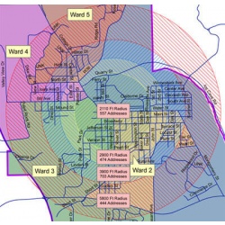
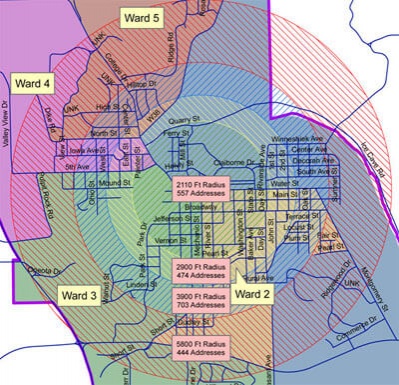
This is a great new software system. But over the weekend, I realized that there's no equivalent for sidewalk conditions in Decorah. Instead, the current drive to install sidewalk in the city is based on four circles drawn on a map. Our entire system is based on "Zone 1," "Zone 2," etc. up to Zone 5.
Wouldn't it be better to have a system that is based on which routes are walked most by children going to school? Which blocks have the highest traffic counts and pose the greatest dangers to pedestrians? Which blocks have adjoining sidewalks which are in bad condition and could be repaired or replaced at the same time new sidewalks are built?
Instead, we have a system which is, as lawyers like to say, "arbitrary and capricious." That's the exact opposite of our street repair program, which is using data to determine which roads need to be repaired first.
(decorahnews.com welcomes opposing opinions. E-mail news@decorahnews.com. Letters to the Editor are limited to 300 words)
Copyright © - decorahnewsarchive.com. All rights reserved.| Terms Of Use Statement.

Site designed and maintained by Iroc Web Design Services©.
Your Small Business Web Design Solutions.™
Site designed and maintained by Iroc Web Design Services©.
Your Small Business Web Design Solutions.™


