Ask Mr. Answer Person: Why was 2008's flood stage higher when 2016's flooding did more damage in Freeport?
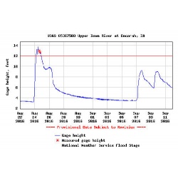
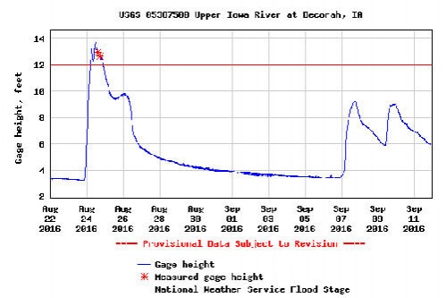
Kevin e-mails: "Why is it that in June of 2008 Freeport did not have the damage that occurred in August of 2016 flooding, even though the river crest in 2008 was 17.90 feet and in 2016 was 13.80 feet?"
Mr. Answer Person says, "Yours is a question I've heard from quite a few people--even though the answer is quite simple. The flood gauge for Decorah is located on the Upper Iowa River at the west end of Main Street. In 2008, the heaviest rainfall came from upriver--Bluffton, Kendallville and even Minnesota. In 2016, the heaviest rainfall came from right in Decorah and even over Trout Run Creek.
That means a flood gauge on the east end of Main Street wouldn't catch all the rainfall that fell downriver from the gauge.
Still not convinced? Then think about how snowfall totals can vary, depending on where you live. You could get six inches of snow in Bluffton and just three inches in Decorah. The differences also show up when it comes to high temperatures.
Also, much of the floodwater actually came as a flash flood from the hills to the southeast of Freeport--and not from the Upper Iowa River.
So the quick answer to your question is that each flood is different, affected by where the water comes from and a river gauge measures conditions only where it is located.
Site designed and maintained by Iroc Web Design Services©.
Your Small Business Web Design Solutions.™


