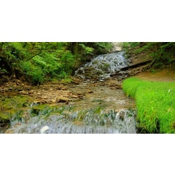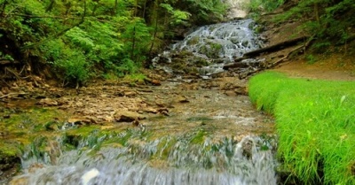
Just how tall is Dunning's Springs? (Part Two)
"Smithsonian Magazine" certainly started a conversation when, in naming Decorah one of America's Top 20 Small Towns, it mentioned Dunning's Springs and called it a "200-foot waterfall."
Niagara Falls (on the America side) is just 167 feet tall, so calling Dunning's Springs a "200-foot waterfall" seems to be stretching the truth. Here's what our readers had to say:
--"Dunning's Spring is more like 200 feet long." --Cyndi
--"Perhaps 200 feet to the top of the limestone outcropping behind it?" --Stan
--"I recall reading, perhaps in George Knudson's book, "Trolls and Trails (or Trails and Trolls??) of Decorah," that the TOTAL HEIGHT from the top, i.e., above the falls, is estimated at 200 feet. I estimate the water drop at about 50 feet." --Karl
--"I used Google Altitude to find the altitude drop of Dunning's springs. From the top of the hill above the cave to the edge of the Upper Iowa River it is approximately 132 feet. From the base of the cave where the water comes out to the Upper Iowa River is about 38 feet drop." --Kevin
--"It looks like the parking lot elevation is about 950 feet, and the top of the falls might be between 990 and 1000 feet. (40-50 foot drop) --Tim
--"Michele Maki, who photographed waterfalls in all 50 states, says Dunning Springs is a 40 foot drop." --Jerry
In addition to our reader e-mails, we received input from both city and county officials:
--"Depending on what one considers "the falls" I would say we are closer to 60 feet. Our topography would take a little to blow up and refine for a better answer, but I think this is in the ballpark. I am guessing that 200 feet may have come from the relief of the bluffside as opposed to just the falls. Not sure off the top of my head, but 200 feet begins to put you in National Park range." –City Engineering consultant Lindsay Erdman
--"Using the County's GIS software and 2 foot contour data processed from data collected during the State's 2007 LiDAR flight I have some measurements that might help your readers. The top of the ridge above the spring measures approximately 1,020 ft. The pool where the spring emerges from the side hill measures 948 feet. The entrance to the park on Ice Cave Rd measures 866 ft and the top of the river bank South of that entrance, measures 858 feet. I did also measure the distance along the spring's cascading section and it was approximately 200 feet long. So my guess is that article might be addressing the falls itself and not the vertical component, but I have not read the quoted article." –County GIS Coordinator Jon Lubke.
OK--we're ready to declare that "Smithsonian Magazine" overshot the mark by a measure of four times. That's a guess on our part, but it seems in the ballpark. Of course, one of our readers had a suggestion on how we could get an exact reading:
--"Take a tape measure and have an agile reporter head to the top of the falls and let the esteemed editor stay at the bottom with the spool of the tape measure and record what you see as an answer. Hint: you will need a 200 foot tape." Darryl
Site designed and maintained by Iroc Web Design Services©.
Your Small Business Web Design Solutions.™


