Winneshiek County residents get first look at updated soil survey
The last time the Winneshiek County Soil Survey was updated, the contents filled a large loose-leaf binder. This time around, the contents fit on one DVD.
Representatives from the Natural Resources Conservation Service, Iowa Department of Agriculture and Land Stewardship and the Iowa State University Extension program on Thursday introduced the new, state-of-the-art Winneshiek County Soil Survey.
Not only is the information updated for the first time in 41 years, but the format is radically different. People will now be able to access the information through the Extension's website. Officials on Thursday also gave a demonstration of the interactive DVD which uses a GIS program that works with most home or office computers. The GIS software can be used to get a variety of information from the soil survey--such as which land would be good to grow corn or soybeans, which land would be good for a septic drainage field and which land has sinkholes.
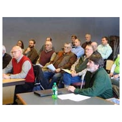
A crowd of around 40 people attended Thursday afternoon's meeting. Iowa State University Extension and the Natural Resources Conservation Service (NRCS) are also hosting two training sessions on January 20th for people interested in learning more about the new survey.
Site designed and maintained by Iroc Web Design Services©.
Your Small Business Web Design Solutions.™


